
Urban mobility represents a growing challenge that requires innovative and efficient solutions to improve the quality of life in cities. Problems such as traffic congestion, long travel times and environmental pollution impact both the productivity and health of the population. To address these challenges, it is essential to adopt a technological approach that incorporates advanced tools such as artificial intelligence (IA).
Artificial Intelligence has revolutionized transportation planning and management through massive data analysis in real time. According to the Inter-American Development Bank (IDB), “these technologies can reduce data collection costs by 80% and analysis times by 50%, allowing cities to make quick, evidence-based decisions.” A notable example of this transformation is the initiative implemented in Boston, United States, where, according to the city government, it describes how Waze for Cities was used to analyze traffic congestion on Center Street, West Roxbury, following a road safety redesign in 2023. This street was one of the busiest and with a high incidence of traffic accidents due to excessive speed. Travel data was collected to assess changes in speed and congestion before, during and after the project. The results showed a 75% reduction in speeding, while travel times increased by only 1-2 minutes, which has made it possible to optimize circulation and increase the efficiency of transport in the city. Likewise, The Sun newspaper indicates that “in the city of Fremont, California, the application of artificial intelligence has made it possible to reduce the response times of emergency vehicles by 69%, reducing the average time from 46 to 14 minutes.” This improvement was achieved by optimizing traffic light patterns to provide consistent green lights at intersections, facilitating the rapid passage of ambulances and other emergency services.
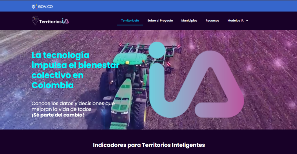
The Territorios IA platform, recently launched by the Ministry of Information and Communications Technologies of Colombia (MinTIC) with the participation of the Francisco José de Caldas District University and the AI research company for GovTech, Cuantico, is consolidated as a fundamental pillar in the digital transformation of the territories, driven by the use of open data and artificial intelligence (AI). This initiative seeks to optimize public management by integrating predictive models and real-time data analysis, allowing territorial entities to make strategic decisions based on evidence, improving operational efficiency and the quality of life of citizens.
Territories IA has benefited 54 municipalities, this platform will be available in their electronic headquarters, allowing real-time analysis and visualization of data provided by Waze for Cities through a geovisor. With this tool, municipalities will be able to more efficiently monitor traffic congestion, identify risks and manage traffic incidents. This will allow them to make more informed decisions and implement preventive and strategic measures with greater precision, such as optimizing road signage, making adjustments to infrastructure and improving traffic management, thus contributing to safer and more efficient mobility and improving the quality of life of communities. In addition, it strengthens regional innovation ecosystems, promoting digital solutions that position Colombia as a digital, competitive and globally connected power. To learn more about the benefited municipalities, visit: Territorios IA
On this map, you can see in which sectors there are traffic jams or slow traffic. In this particular study, the main sources of congestion are found on the roads that connect the urban center with surrounding areas, as well as at intersections with high vehicular flow. By using georeferenced data, it is possible to precisely delimit the points where traffic is concentrated, which facilitates the development of circulation plans, the design of detours and the coordination of actions of traffic authorities. With this information, specific measures can be defined for peak hours and minimize delays that affect local mobility.
In the specific case of La Mesa, Cundinamarca, the platform allows access to additional geospatial layers, such as the location of community action boards, neighborhood delimitation, paths, streams, rivers, rural or urban roads, population centers, facilitating more detailed and participatory territorial planning.
Altogether, Territories IA represents a significant advance towards the construction of smart governments, where technology and data become strategic allies for sustainable development and continuous improvement of public management. Projects such as Territories IA have contributed to Colombia standing out as the country with the best Digital Government index according to the Organization for Economic Cooperation and Development (OECD). These high-impact initiatives not only generate immediate benefits, but also offer greater ease of deployment with other environmental and mobility platforms specific to municipalities. In this way, local capacities are complemented and decision-making processes are strengthened, promoting more efficient and inclusive territorial development for all citizens.